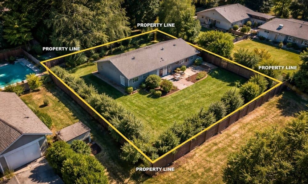
If you hear that Houston has no zoning, it sounds simple. At first, you might think you can build anything you want. However, that idea causes a lot of problems for property owners. Houston is different, but it is not without rules. Instead of one zoning map, the city uses a mix of property records, plats, and local standards. Because of that, the limits on your land are not always clear right away. As a result, many people move forward based on assumptions. Then later, they run into issues they did not expect. That is where a land survey becomes important, because it gives you a clearer picture of what you’re actually working with before you make any big decisions.
Why a Land Survey Still Matters
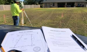
Even without zoning, your property still has boundaries and limits. A land survey helps you see those in a way that’s easy to understand.
At first, a piece of land might look open and simple. However, that can be misleading. Once you take a closer look, you start to see how the space is really laid out and where your boundaries actually are.
That’s where it all starts to click. You begin understanding your property boundaries in a way that makes sense, and it becomes easier to see what you can and can’t do with the land.
Because of that, your decisions feel a lot more straightforward. You’re not guessing anymore. Instead, you’re working with what’s actually there. Over time, that can help you avoid costly mistakes.
Where Assumptions Start to Cause Problems
Many property owners feel confident because of the “no zoning” idea. So they move quickly. They buy land, make plans, or start thinking about construction.
However, things often change once details come into play.
For example, a lot may look large enough for a project. But after reviewing the property more closely, the usable space may not match expectations. In other cases, planned improvements may not fit the layout the way the owner imagined.
Because of this, early assumptions can lead to redesigns, delays, and added costs. A land survey helps prevent that by giving a clear starting point.
How Real Projects Get Affected
Think about buying a property that looks perfect at first glance. You picture exactly what you want to build. Everything seems to line up.
Then, once you dig deeper, the situation changes. The layout may not work the way you expected. The space may feel different when measured accurately.
The same thing happens when people try to improve older properties. Over time, changes can happen that are not obvious right away. Because of that, what you see today may not fully match what is recorded.
In these situations, a land survey brings everything into focus. It helps you understand what is really there, not just what it looks like.
Why Timing Can Make or Break Your Project
One of the biggest mistakes people make is getting a land survey at the wrong time.
Some order it too early. At that stage, they may not even know what they need. So the information they get may not fully support their plans.
Others wait too long. By then, they may already have designs or ideas that do not fit the property. That leads to changes that could have been avoided.
So timing matters. When your plan is clear enough, that is the right time to bring in a survey. This way, the information works with your goals, not against them.
Why a Land Survey Is Only Part of the Process

A land survey gives you accurate data. However, it does not decide what you should do next.
You still need to look at that information and understand how it affects your plans. Sometimes, that means adjusting your layout. Other times, it means rethinking your approach.
Because of that, the survey works best when it supports your decision-making. It is not the final answer. Instead, it is a tool that helps you move forward with confidence.
What Smart Property Owners Do Differently
People who avoid problems usually take a different path. First, they slow down and ask questions. Instead of assuming their land has no limits, they take time to understand it.
Then, they connect their plans with the right information. They do not treat a land survey as a simple requirement. Instead, they see it as part of a bigger process.
Because of that, they avoid surprises. They also save time and money in the long run.
Final Thoughts on Planning in Houston
Houston offers flexibility, and that can be a great advantage. However, it also means you need to be more careful.
Without zoning, the responsibility shifts to the property owner. You have to make sure your decisions are based on real information, not assumptions.
A land survey helps you do exactly that. It gives you a clear view of your property so you can plan the right way.
So before you move forward, take the time to understand your land. That one step can make the difference between a smooth project and a stressful one.