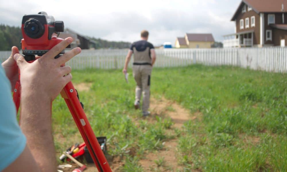
Ground collapse stories spread fast online. A street drops. A yard sinks. A driveway cracks overnight. Naturally, people watch those clips and think, “That’s scary — but that won’t happen on my property.” Still, ground problems rarely begin with a dramatic collapse. Most of the time, land sends small warning signals first. That’s why a property land survey matters in ways many owners never consider. Most people think surveys only show boundary lines. In reality, they also reveal how land slopes, how water flows, and how ground levels change across a lot. In other words, they help you understand how your property behaves — not just where it starts and ends.
So after local ground failure news makes the rounds, it makes sense to look at your own land with a more informed eye.
Why Ground Failure News Should Matter to Ordinary Property Owners
When major ground failures hit the news, they often involve roads or large public areas. However, smaller versions of the same problems happen on private property all the time. The difference is scale — not cause.
Soil weakens when water collects in the wrong places. Ground settles when fill compacts unevenly. Slopes erode when runoff cuts new paths. These processes don’t happen overnight. Instead, they build slowly and quietly.
Because of that, homeowners often normalize the signs. A low wet patch becomes “just how that corner is.” A slight dip in the yard becomes easy to ignore. Meanwhile, the ground continues to shift.
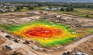
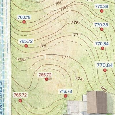
A property land survey gives measured detail about elevation and grade. Therefore, it replaces visual guesswork with real numbers and mapped patterns.
Most Land Trouble Starts With Water — Not Holes
Despite what viral videos suggest, giant holes don’t appear out of nowhere. Water almost always plays a role first. When runoff flows across a lot, it carries soil with it. When drainage stalls, the ground stays saturated longer. Over time, that weakens support.
However, most owners judge drainage by memory, not measurement. They recall where water “usually” goes. Yet storms change patterns. Landscaping changes flow. New hard surfaces redirect runoff.
Survey elevation and topographic data show slope direction clearly. As a result, you can see whether water exits your property efficiently or lingers where it shouldn’t. That insight often explains why certain areas stay soft or settle faster.
Subtle Low Areas Tell a Bigger Story Than You Think
Many people only worry about obvious depressions. Still, small low spots often signal larger grading issues. Even a few inches of elevation difference can hold water longer than surrounding ground.
You might notice that one part of the yard dries slower. Grass grows thicker there. Soil feels softer after rain. These details seem minor at first. However, they point to uneven elevation behavior.
A property land survey with spot elevations maps these small height differences. Consequently, you understand which areas collect water and which areas shed it. That pattern helps predict where future settlement may occur.
Changed Ground Deserves a Second Look
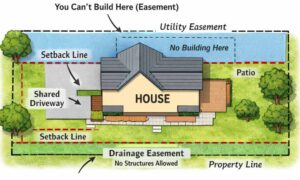
Lots rarely stay exactly as built. Owners add patios, extend driveways, level play areas, and reshape landscaping. Builders also place fill during original construction. While those changes improve usability, they also change ground performance.
Fill soil, for example, compacts differently from natural soil. Over time, it may settle more. That settlement can affect nearby surfaces and grading.
Older surveys often show original grade intent. When you compare that with current site conditions, differences stand out. An updated property land survey captures today’s elevations and features, which gives you a fresh baseline instead of relying on outdated ground data.
Slopes and Edges Don’t Need to Be Steep to Matter
When people think about slope risk, they picture cliffs or hillsides. Yet many ground issues happen on mild grade changes. Small retaining edges, berms, and cut transitions often fail quietly because they look harmless.
Rainwater tends to speed up along even gentle slopes. Then it removes fine soil particles first. Gradually, that erosion undercuts support. Owners may only notice after cracks or small slides appear.
Survey grade mapping shows true slope percentages. Therefore, you can judge whether a “gentle” slope actually moves water faster than expected. That knowledge helps guide drainage improvements before erosion grows.
Structures Feel the Impact of Ground Movement First
Interestingly, open yard areas can tolerate some settlement without obvious damage. Structures cannot. Driveways, patios, and foundations show movement faster because they depend on stable support.
You might see small separation lines, joint gaps, or edge settling. Many people blame the concrete or masonry itself. However, ground support often tells the real story.
A property land survey that includes structure-adjacent elevations helps show whether surrounding grade directs water toward or away from these built elements. That relationship often explains why one slab corner settles while others stay stable.
Elevation Position Still Matters Outside Flood Zones
Flood maps get most of the attention, yet relative elevation matters even when a property sits outside mapped flood areas. Lots that sit slightly lower than neighbors receive more runoff. Lots near drainage corridors carry higher soil moisture loads.
Because of that, two homes on the same street may experience very different ground behavior. One drains quickly. The other stays wet longer.
Survey elevation data shows how your lot sits in relation to surrounding ground. As a result, you understand runoff exposure better than any map shading alone can show.
Measured Land Knowledge Beats Assumptions Every Time
Ground failure news goes viral because it feels sudden and shocking. In truth, land problems usually develop through small, measurable changes. Water paths shift. Soil compacts. Elevations vary. Slopes redirect flow.
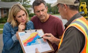
A property land survey turns those hidden patterns into visible data. Instead of relying on memory or appearance, you rely on measurements and mapped conditions. At that point, many owners decide to get your property boundary surveyed simply to make sure what’s on paper still matches what’s happening on the ground.
That doesn’t mean every property faces collapse risk. However, every owner benefits from understanding how their land actually behaves. When you know your ground, you make smarter choices about drainage, improvements, and long-term protection — and that’s far more useful than reacting after the fact.