A construction staking survey might sound fancy, but it’s one of the smartest steps you can take before building. Think of it this way: your plans are the recipe, and the survey is what makes sure the cake comes out of the oven the right shape and size. Without this step, you’re basically guessing where things should go. And in a busy city like Houston, guessing can cost you big.
What Is a Construction Staking Survey?
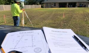
So, what is it exactly? Picture this: your architect or engineer draws up a beautiful design. But someone has to take those lines on paper and show the builder where to put the foundation, driveway, or utility lines in real life. That’s where the construction staking survey comes in.
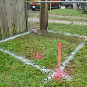
During the process, a licensed land surveyor shows up with high-tech gear—GPS, lasers, robotic tools—and marks the ground with stakes, flags, or paint. These little markers are like a cheat sheet for builders. Instead of guessing, crews follow the stakes, and the project lines up exactly as planned.
In Houston, where properties range from tight downtown lots to sprawling suburban land, this step keeps projects accurate and helps avoid costly surprises.
Why It Really Matters
Growth in Houston never slows down. One week it’s new homes in Katy, the next it’s a commercial build in The Woodlands. With so much happening, accuracy matters more than ever. Here’s why a construction staking survey makes sense:
- Improves accuracy – Builders know exactly where to work instead of relying on guesswork.
- Ensures compliance – Houston has zoning and permit rules, and a staking survey helps keep projects within legal limits.
- Saves time – Clear markers reduce confusion, arguments, and rework on site.
- Protects safety – Staking utilities means crews don’t dig into water or power lines.
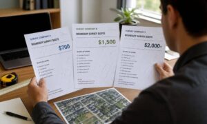
In short, the cost of a construction staking survey is always less than the cost of fixing a big mistake later.
What Happens During a Construction Staking Survey

If you’ve never had one done before, don’t worry—it’s straightforward.
Step 1: Before the surveyor comes out
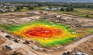
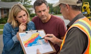
First, they study your plans, check property details, and look at local requirements. In Houston, that often means paying close attention to drainage issues and floodplain maps.
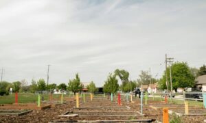
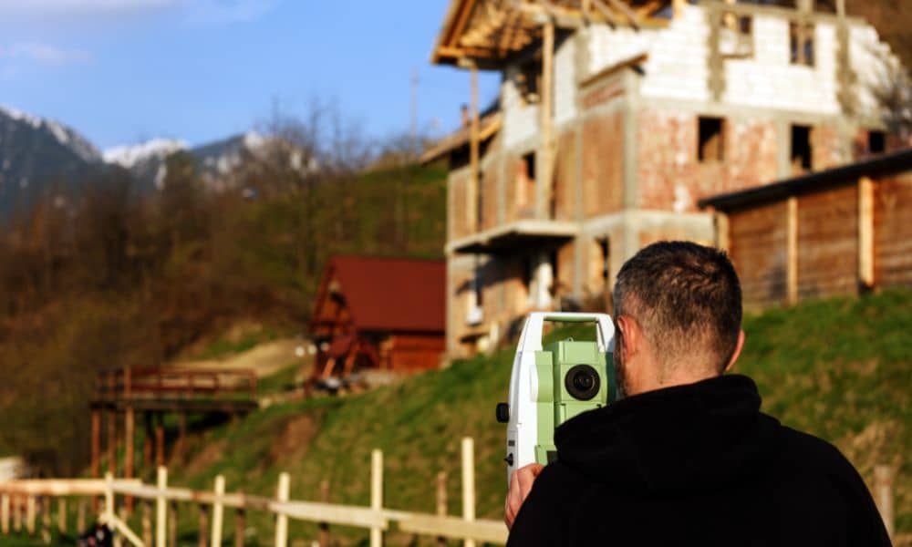
Step 2: On-site work
Next, the surveyor arrives with advanced tools. Using GPS and laser technology, they place stakes or flags where the foundation, walls, or roads should go. These marks become the blueprint on the ground for the builder to follow.
Step 3: Confirmation
Finally, you’ll receive a report or map confirming everything lines up. With that record in hand, you and your builder can move forward confidently.
Who Actually Needs This Survey?
The truth is, almost anyone starting a construction project benefits from this survey.
- Homeowners building a house, garage, or major addition.
- Developers laying out new neighborhoods or retail sites.
- Contractors handling infrastructure such as roads, utilities, or pipelines.
Whether you’re working on a small addition in Midtown or a large subdivision in Sugar Land, a construction staking survey gives you the peace of mind that everything is where it should be.
What Happens If You Skip It?
Some folks try to save money by skipping this step. However, that choice usually leads to headaches. For example:
You could pour a slab in the wrong spot—then pay to tear it out.
Building across a property line might spark costly legal disputes.
Digging without layout guidance risks hitting water or electrical lines.
Delays pile up, draining both time and money.
In Houston, where timelines are tight, any one of these problems can derail a project quickly.
How to Choose the Right Surveyor
The good news is that finding the right surveyor isn’t difficult if you know what to ask:
- Are they licensed in Texas? (This is non-negotiable.)
- Do they have experience with projects similar to yours?
- What kind of tools do they use—modern GPS and robotic equipment, or outdated methods?
- Do they understand zoning and floodplain rules in your area?
A reliable surveyor won’t just pound a few stakes and leave. Instead, they’ll explain what’s happening, answer your questions, and often provide a full range of land survey services to support every stage of your project.
Why Every Project Depends on It
Building is stressful enough—you don’t need added problems. A construction staking survey works like an insurance policy that keeps your project on track. Whether you’re putting up a small backyard addition or developing a multi-lot subdivision, staking turns design into something solid you can trust.
From The Heights to Pearland—and in cities all over the country—builders rely on staking surveys because they keep projects accurate, safe, and legal.
Final Thoughts
At the end of the day, every good project starts with a clear plan. A construction staking survey is what brings that plan to life. Without it, you’re rolling the dice.
So, whether you’re starting a home project or planning a bigger development, bring in a licensed surveyor before breaking ground. This small step saves you time, money, and a whole lot of stress later.