Houston has always dealt with water. Heavy rain, flat land, and nearby bayous shape how the city grows. Recently, however, floodplain building has come back into focus. Local talks about building in flood-risk areas have raised questions about safety, permits, and planning. Most news stories focus on large projects. However, the same issues can affect regular homeowners. In fact, anyone planning to build, renovate, or expand a home in Houston may face these rules. Because of this, many homeowners begin with a residential land survey before starting construction. This step often prevents problems that could delay a project or raise costs.
Why Houston’s Floodplain Debate Matters to Homeowners
Floodplain debates may sound like something that only affects developers or city leaders. However, they also affect what homeowners can do on their own land.
Houston has many neighborhoods near bayous, drainage channels, and low areas. When strong storms arrive, these places can flood quickly. Because of that, the city and county have rules that guide how building happens in these areas.
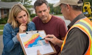
The current debate shows that floodplain lines are not always simple. Sometimes land that looks safe may still fall inside a flood zone. When that happens, homeowners may need to meet certain rules before starting a project.
For example, someone planning a home addition may need proof that the new space sits outside restricted areas. Another homeowner may need papers that show where drainage easements are located. These issues often appear during the permit process.
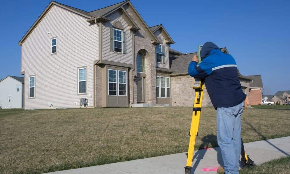
That is where a residential land survey becomes useful. It gives clear and verified details about the property before construction begins.
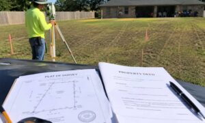
What a Residential Land Survey Shows
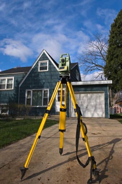
Many homeowners know what a survey is, but they may not know what it shows. A residential land survey is more than a simple property map. Instead, it gives a clear view of the land and the structures built on it.
Surveyors measure the property and mark key features that may affect construction. They identify property lines and show where buildings, driveways, and fences sit on the lot. They also mark easements and setback lines that limit where new structures can go.
Because surveyors use precise tools and property records, builders, architects, and city permit offices trust their work.
As a result, homeowners gain clarity. Instead of guessing where boundaries are, they can see exactly how their property is laid out.
Floodplain Rules Can Affect Simple Home Projects
Many homeowners believe floodplain rules apply only to large developments. However, smaller home projects can also be affected.
For example, a homeowner may want to add a room to the house. Another may plan to install a pool or outdoor kitchen. Some may simply want to extend a driveway or build a fence.
Even though these projects seem simple, they still involve property lines, setbacks, and drainage areas. If a structure sits inside a restricted zone, the city may not approve the permit.
This often surprises homeowners. They may think their backyard has no limits. However, drainage easements sometimes cross residential lots, especially in older Houston neighborhoods.
A residential land survey helps show these details before construction begins. Because of this, homeowners can adjust their plans early instead of facing delays later.
Why Online Maps Can Cause Problems
Today, homeowners can easily view property maps online. County websites and real estate platforms show parcel maps in seconds. While these tools look helpful, they usually provide only rough estimates.
Online maps often use older data or simple graphics. They may show boundary lines that appear correct but do not match the legal property records.
Because of this, homeowners sometimes make decisions based on maps that are not exact. Someone might build a fence where they think the boundary sits. Later, they may learn the fence crosses into a neighbor’s land.
Situations like this can create tension between neighbors and lead to costly fixes. In contrast, a residential land survey uses precise measurements and legal records to confirm the true property lines.
That accuracy makes surveys the trusted source for construction projects.
Real Situations Where Surveys Help Homeowners
Across Houston, many homeowners order surveys only after problems appear. However, those problems often begin with small misunderstandings about property lines.
For example, a homeowner may start installing a fence without checking the boundary first. Later, the neighbor questions the fence location, and the disagreement grows. A survey then becomes necessary to settle the issue.
In another case, a homeowner may plan a new garage or patio extension. The design may look perfect. However, the city might require proof that the structure stays within setback rules before approving the permit.
Without a survey, the project must pause while measurements are taken.
Situations like these happen often. Fortunately, a residential land survey can prevent them before they start.
Skipping a Survey Can Cost More Later
Some homeowners avoid ordering a survey because they want to save money. However, skipping this step can lead to larger costs later.
Construction depends on accurate property details. If boundaries or easements are unclear, builders may place structures in the wrong spot.
Fixing these mistakes can require redesigning plans or even removing structures that were just built. In some cases, disputes with neighbors may occur if construction crosses property lines.
These problems often cost far more than a survey would have. Because of this, many builders suggest confirming property details before construction begins.
Planning Ahead Makes Building Easier
Houston’s floodplain discussions remind homeowners of something important. Building on land always requires careful planning.
While the current debate focuses on large projects, it highlights the same issues homeowners face when improving their property. Boundaries, drainage, and building limits all affect how land can be used.
A residential land survey helps answer these questions early. It gives homeowners a clear picture of their property and helps builders plan safely. For many homeowners, this starts with a simple conversation with a land surveyor in Houston who can explain the property lines and point out anything that might affect future construction.
Most importantly, taking this step early allows homeowners to move forward with confidence.
In a city like Houston, where weather and building rules keep changing, understanding your property is one of the smartest things you can do before building or renovating.