A recent dispute over an overgrown lot in Houston spread fast online. Neighbors shared photos. Frustration grew. Comments piled up. Yet beneath the noise, one question stayed unanswered longer than it should have: Who is actually responsible for that land? This situation feels familiar to many property owners. A vacant lot sits nearby. Grass grows tall. Trash collects. Neighbors complain, but no one knows who owns it. The city cannot act. The owner stays silent. Eventually, the problem becomes public. What many people do not realize is that these disputes rarely start with neglect. They start with uncertainty. More specifically, they start when no one has a clear lot survey.
Why Overgrown Lots Cause So Much Conflict
At first glance, an overgrown lot seems like a basic maintenance issue. Someone should mow it. Someone should clean it. However, without clear property boundaries, responsibility becomes a guessing game.
In Houston, many lots change hands over time. Some belong to investors who live elsewhere. Others sit between older homes with outdated records. Online parcel maps give rough outlines, but those maps do not carry legal weight. As a result, neighbors rely on fences, trees, or memory. Unfortunately, those markers often sit in the wrong place.
Because of that, people complain to the wrong owner or pressure the city to act without proof. Nothing moves forward, and frustration builds.
The Hidden Problem: Assuming You Know Where the Lot Ends
Most property disputes come down to assumptions. A fence looks straight, so it must be right. A map online shows a line, so it must be accurate. Yet neither guarantees legal accuracy.
Online maps can shift several feet. Old fences may have been installed for convenience, not accuracy. Over time, those small errors turn into major disagreements. When a dispute goes public, everyone suddenly wants proof. That is when the lack of a lot survey becomes obvious.
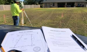
A lot survey replaces assumptions with facts. It shows the true legal boundaries of a property based on recorded documents and field measurements.
What a Lot Survey Really Does
Many people think a lot survey only matters during a property sale. In reality, it plays a much larger role.
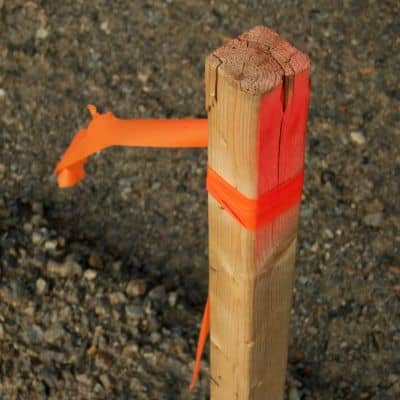
A lot survey confirm where a property begins and ends. It identifies corners, boundary lines, and how the lot relates to neighboring parcels. Because licensed surveyors follow strict standards, their findings carry legal authority.
That authority matters when responsibility is questioned. Once the boundary is clear, there is no debate about who must maintain the land.
How a Lot Survey Assigns Legal Responsibility
When an overgrown lot creates problems, enforcement depends on accuracy. Code enforcement cannot issue notices or fines without knowing who owns the land. HOAs cannot enforce rules without proof. Even neighbors cannot escalate issues without clear documentation.
A lot survey provide that clarity. If the overgrown area falls inside a property’s legal boundaries, the owner is responsible. If it does not, responsibility shifts. That simple determination unlocks action.
Instead of arguing opinions, everyone works from the same verified information.
Why the City Often Appears Slow to Respond
Many homeowners wonder why the city does not step in sooner. The reason is liability. Acting without confirmed boundaries risks targeting the wrong owner or entering private property without permission.
A lot survey protects everyone involved. It allows the city to act confidently while protecting property owners from incorrect enforcement. Without it, officials must wait, even when the problem is obvious.
What Happens When No Lot Survey Exists
When no survey exists, disputes drag on. Neighbors argue. Complaints repeat. Online discussions grow louder. Still, nothing changes.
Over time, the situation often worsens. Property values suffer. Legal letters appear. Tensions rise between neighbors who once got along. At that point, the cost of delay often exceeds the cost of a survey.
Yet many people only realize this after the damage is done.
Situations Houston Property Owners Face Every Day
These disputes affect more than one type of owner. Homeowners next to vacant lots feel stuck when no one responds. Investors receive unexpected violation notices. HOAs struggle to enforce maintenance rules. Buyers plan improvements only to learn too late that part of the land is not theirs.
In each case, the outcome changes once a lot survey enter the picture. Clarity replaces confusion. Responsibility becomes enforceable.
Knowing When to Act Before Problems Escalate
You do not need a viral dispute to justify a lot survey. Early action prevents small issues from becoming public conflicts.
If you receive a violation notice, notice tension with a neighbor, or plan work near a property line, that is the right time to act. Waiting rarely improves the situation. It only increases stress and risk.
Why Professional Surveys Matter
Only surveys prepared by licensed professionals meet legal standards. Hand-drawn sketches or online maps do not carry the same weight.
Licensed surveyors use verified records, field measurements, and established procedures. Their work stands up during disputes, enforcement actions, and legal review. That reliability protects your interests when responsibility is questioned.
The Real Lesson From Houston’s Viral Lot Dispute
The viral dispute was never about grass or trash. It was about uncertainty.
A lot survey answer the one question everyone needs answered first: Who is legally responsible? Once that answer exists, solutions follow quickly.
If you own property near a vacant or disputed lot, clarity now prevents conflict later. Clear boundaries keep small problems from becoming public ones.