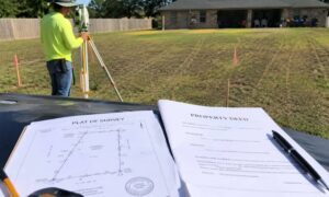
Plat of Survey vs. Property Deed: Which One Actually Shows Your Lines?
A plat of survey is a drawn map that shows the exact size and shape of a property. A property deed is a written document

Why Boundary Survey Cost Varies So Much
Getting a boundary survey in Houston sounds simple at first. You call a few companies, ask for a price, and expect something close. Then reality
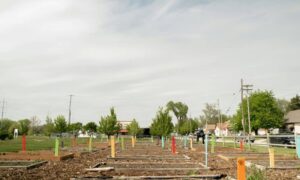
How a Construction Surveyor Checks What You Can Build
You buy a lot in Houston and it looks wide enough. You picture a garage or maybe an extra room in the back. At first,
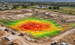
How Lidar Mapping Helps You Spot Hidden Low Spots Early
Houston land can trick you. A lot may look flat and ready. The surface feels smooth. Nothing stands out, so it seems safe to build.
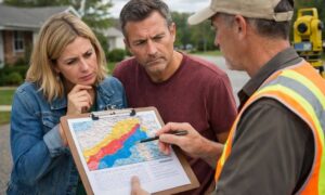
Confused by Flood Maps? How a Land Survey Company Helps
If you’ve been hearing about the new flood maps, you’re not alone — they’re causing a lot of confusion. Areas that weren’t considered at risk
Finding Land Surveyors Starts With the Right Questions
Searching for land surveyors in my area usually starts when a property decision feels urgent. Maybe you are buying land, planning an addition, checking a