Houston drivers already know the pain of sitting in I-10 traffic. But starting this month, that frustration has a new reason. TxDOT is cutting westbound I-10 down to two lanes near White Oak Bayou so crews can raise the highway above the floodplain. The project will take about two years, and while it’s meant to protect the city from future flooding, it’s also affecting how construction work gets done across Houston—including your next construction staking survey.
You might not connect highway construction with your residential or commercial project, but the truth is, the two are linked. When the city raises roads and updates flood elevations, surveyors, builders, and engineers all feel the ripple effect.
The Real Reason Houston Is Lifting a Highway
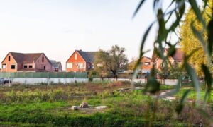
White Oak Bayou has long been one of Houston’s problem areas when it rains. After years of heavy floods, TxDOT and Harris County are investing millions to elevate key roadways and improve drainage. To do that, they’re using updated Base Flood Elevations (BFEs)—the same elevation data that surveyors rely on when marking building corners, grading lots, or staking foundations.
When flood control projects like this happen, elevation benchmarks often change. That means every nearby project—whether it’s a driveway expansion, a new home foundation, or a small commercial build—must align with the latest control points and flood maps. In short, the I-10 project isn’t just lifting a road; it’s raising the bar for how precise every construction staking survey needs to be in flood-prone areas of Houston.
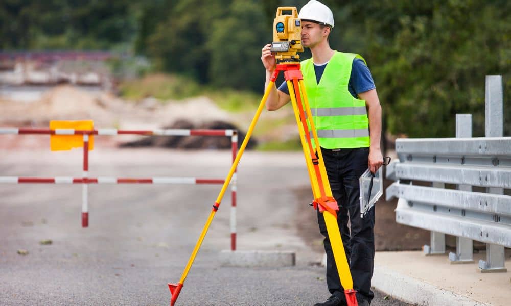
Why a Highway Project Can Raise Your Survey Costs
Let’s be honest: most property owners think survey costs come down to land size and complexity. But location, access, and data updates matter just as much. The I-10 project is a perfect example of how public infrastructure changes can affect private projects in three big ways.
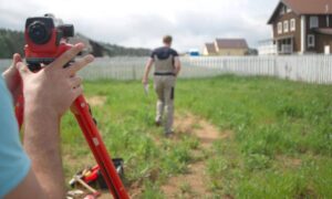
1. Harder Access = Longer Field Time: Survey crews often work near major corridors. With lane closures, detours, and limited staging areas, getting equipment and personnel to the site takes longer. Even setting up safe zones for crews now requires coordination with city traffic teams. That added time means more labor—and higher bills.
2. Benchmark Verification Takes Longer: When the county adjusts flood elevations, surveyors have to double-check the control points that keep your site accurate. If your project sits near a bayou, a new benchmark might replace the one your engineer used a few years ago. Re-verifying those points ensures your foundation isn’t set too low—or worse, outside the permitted floodplain elevation.
3. Coordination Delays With City Review: Every project that touches grading, drainage, or foundation design needs accurate staking data for approvals. But as flood projects expand, so do review times at the city and county levels. A delay in verification means your staking crew can’t set up on schedule, pushing everything else behind—plumbing, framing, inspections, and even closing timelines.
How This Impacts Builders and Developers
For builders, delays are money. A few extra survey hours may not sound like much, but a small scheduling slip can snowball fast. Imagine your crew ready to pour concrete, but the staking team is waiting on flood data confirmation. That downtime costs labor hours, fuel, and sometimes even rental equipment fees.
For developers, the challenge is coordination. When multiple contractors—engineers, surveyors, and site crews—are trying to line up under changing flood standards, even a simple project can feel like a puzzle.
And for homeowners, it can mean confusion. You might see “construction staking survey” on your estimate and wonder why it suddenly costs more this year than last. The answer lies under your tires: Houston’s roads and flood systems are changing, and your survey has to change with them.
The Benchmark Problem Most People Miss

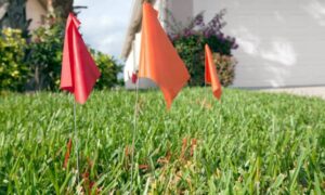
Surveyors don’t just mark points—they measure reality. Every stake they drive into the ground connects back to a fixed benchmark. If that benchmark is off by even a few inches, your foundation could sit lower than the approved flood elevation. That can trigger permit rejections or, worse, post-construction drainage issues.
The recent elevation work on I-10 shows why benchmarks matter so much. As TxDOT recalibrates its control points along the corridor, private projects nearby must do the same. In one recent example, a commercial site north of downtown had to restake its foundation because an old benchmark no longer matched county data. That mistake delayed the job by six weeks and cost thousands in labor and material adjustments.
The lesson? Always confirm your surveyor uses the latest vertical datum—currently NAVD88 in most of Houston—and ties staking points to verified control marks.
Working Smarter Around Flood Zones
Building near a bayou or flood-controlled area doesn’t have to be a nightmare. A good licensed surveyor knows how to anticipate these shifts. Before your next project, ask them a few key questions:
- Are you using the latest flood maps and benchmarks?
- Will my staking include elevation checks tied to NAVD88?
- Can you provide an as-built survey once the foundation is poured?
Those questions might seem technical, but they protect your timeline. A professional who stays current with TxDOT and FEMA data ensures your layout won’t clash with future flood-plain updates—or with your inspector.
Turning Delays Into an Advantage
Here’s the upside: when you plan for the extra time and complexity early, you stay ahead of everyone else. Developers who budget for thorough staking avoid mid-project rework. Homeowners who get updated elevation checks before construction avoid failed inspections.
The I-10 project may slow traffic for two years, but it’s also a wake-up call. Houston is evolving, and the way we build must evolve with it. Surveying isn’t just about property lines anymore—it’s about precision, safety, and compliance in a city shaped by flood risk.
Final Thoughts
When you see orange cones on I-10, think beyond traffic. That same effort to lift a highway above flood waters is the same principle that keeps your property safe and compliant. A construction staking survey today involves more coordination, updated data, and real-world adjustments than ever before.
Choosing a surveyor who understands floodplain changes can save you time, stress, and unexpected costs. So before you break ground, make sure your benchmarks are right, your staking is current, and your surveyor knows the terrain—both on the ground and under the law.