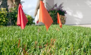
If you own property, you may have noticed more talk about flood maps lately. Real estate agents mention them. Lenders ask questions about them. Insurance companies review them more closely than before. Even buyers now pull flood maps before making an offer. Because of this shift, many property owners are suddenly being asked for a FEMA Elevation Certificate—even when nothing about their property seems to have changed.
So what’s really happening? And more importantly, what should you do before this request turns into a delay, a higher insurance bill, or a stalled deal?
Why Houston Flood Maps Are Getting More Attention Right Now
Houston has always lived with flood risk. However, what’s changing now is how flood data is used, not just how it’s created.
Local agencies and national groups have rolled out more detailed flood-risk tools. These maps are easier to access, easier to share, and easier to misunderstand. Because they show risk visually yet broadly, they often raise red flags during financial reviews.
As a result, lenders and insurers are leaning on these maps earlier in the process. They are not waiting for official FEMA map changes. Instead, they want confirmation that a property truly sits above flood risk levels.
That’s where documentation starts to matter more than ever.
Why Property Owners Are Being Asked for a FEMA Elevation Certificate
Many homeowners are caught off guard when a lender or insurer asks for a FEMA Elevation Certificate. After all, the home may have never flooded. The flood zone may look the same as it did years ago.
Still, requests are rising.
This usually happens during moments that involve financial risk, such as:
- Selling a home
- Refinancing a mortgage
- Renewing flood insurance
- Buying property near a bayou or drainage area
In these situations, decision-makers want facts, not assumptions. Flood maps alone don’t provide property-level proof. They show general risk, not the exact height of your structure.
Because of that gap, they often ask for an elevation certificate to confirm what the map only suggests.
The Problem with Relying Only on Flood Maps
Flood maps are helpful. However, they are not precise for every lot, structure, or building pad.
Maps use models. Models use averages. Yet properties don’t follow averages.
A home can sit higher than nearby land. A building pad may have been raised years ago. Even two houses next door can have different elevations. Flood maps rarely show those differences.
When someone relies only on the map, your property may look riskier than it actually is. That misunderstanding can lead to higher insurance costs or extra lender conditions.
This is why verification has become so important.
How a FEMA Elevation Certificate Changes the Conversation

A FEMA Elevation Certificate gives decision-makers something flood maps cannot: exact elevation data for a specific structure.
Instead of guessing based on color zones or overlays, lenders and insurers can compare real measurements to the base flood elevation. This often brings clarity where maps create confusion.
In many cases, the certificate does not increase risk. Instead, it proves that a building sits higher than assumed. When that happens, insurance premiums may drop. Loan conditions may ease. Closings may move forward.
In short, it turns uncertainty into facts.
Why These Requests Are Happening Before FEMA Updates Maps
One important detail confuses many owners: FEMA may not have officially changed the flood zone, yet requests still come in.
That’s because lenders and insurers don’t wait on map updates alone. They respond to new data tools, internal risk models, and regional trends. When flood awareness increases, documentation standards tighten.
So while FEMA maps move slowly, underwriting practices do not.
This explains why elevation certificates are now requested earlier than before. The goal is prevention, not reaction.
The Role of Licensed Surveyors in This Process
A FEMA Elevation Certificate is not something you can estimate or self-report. It requires precise field measurements and proper documentation.
This is where licensed land surveyors come in.
Surveyors collect accurate elevation data using approved methods. They understand FEMA standards and local conditions. Just as important, they know how to present the information in a format lenders and insurers accept.
In Houston, local experience matters. Soil conditions, development patterns, and drainage systems vary across the city. A surveyor who works in the area understands those details and avoids common errors.
Because of that, many property owners now look for a “licensed surveyor near me”as soon as questions arise.
When You Should Act Instead of Waiting
Timing matters. Waiting until a lender demands an elevation certificate can create stress and delays.
It’s smarter to act early if you are:
- Planning to sell a property
- Preparing to refinance
- Expecting an insurance review
- Buying near a known floodplain
Getting documentation in advance keeps control in your hands. It also allows time to address questions calmly instead of rushing under pressure.
What Property Owners Should Do Now
First, don’t panic. A flood map flag does not mean your property is in trouble.
Next, understand that flood awareness is rising across Houston. That trend is unlikely to slow down.
Finally, take a proactive step. If flood maps raise questions about your property, a FEMA Elevation Certificate can provide answers. It replaces assumptions with facts and helps everyone involved make informed decisions.
For many owners, that clarity protects value, prevents delays, and brings peace of mind.
A Final Thought
Flood risk discussions are changing. They are becoming more data-driven and more detailed. While that can feel overwhelming, it also creates opportunity.
When you have accurate information, you are no longer reacting to maps or models. You are presenting facts about your property.
In today’s market, that makes all the difference.