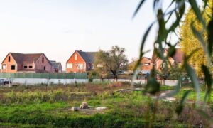
Houston keeps growing fast, with new buildings, busy job sites, and land development everywhere. But even with all this growth, the city also has a big job to do: protecting its coastline and the natural areas around it. Recently, Houston Audubon secured 27 acres of coastal habitat to protect shorebirds and wildlife. Many people celebrated this win, but it also brought new challenges for landowners, engineers, and developers. This is where drone surveying becomes important.
Drone surveying now plays a much bigger role in Houston’s development process. As more land becomes protected or reclassified, developers must understand new boundaries, limits, and environmental rules before starting a project. And because things change so quickly along the coast—like erosion, water movement, and plant growth—fresh aerial data matters more than ever.
This change isn’t about slowing down progress. Instead, it helps people build smarter and avoid costly problems. With more coastal preservation happening, drone surveying gives a clear way to support growth while still protecting nature.
How Coastal Preservation Changes the Planning Process
Houston’s coastline is delicate. Many areas include wetlands, marshes, bird habitats, and land that floods easily. When a group protects a piece of land, like the 27 acres near Bolivar Flats, the area around it changes too. New rules may appear, such as buffer zones, setback lines, or limits on construction near the protected area.
Developers who do not know about these changes often run into trouble. A property might look open for building, but updated maps may show protected plants or shifting habitats. A design might seem fine, but it may not pass new environmental rules once it goes in for review.
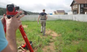
This is why updated mapping is so important. Land near protected areas changes fast, and the old survey data may no longer be correct. Drone surveying helps developers keep up with these changes without confusion.
Why Drone Surveying Matters in Protected Zones
When land becomes protected, surveying methods must also change. Crews cannot always walk into wetlands or bird areas. Heavy tools and field equipment are not allowed in many places. Even small disturbances can break environmental rules.
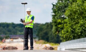
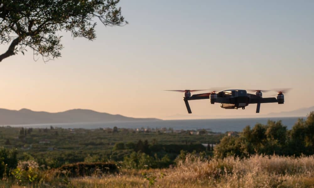
Drones solve this problem because they collect clear, detailed images without stepping into sensitive areas. This is one reason drone surveying is becoming a must-have tool in coastal regions. It respects the land and still gives engineers and planners the information they need.
Drone data also shows the fine details that matter along the coast, such as:
- Moving plant lines
- New water patterns
- Changes in sand or low areas
These details help predict how the land may change over time, especially after storms. Since flooding and erosion shape Houston’s coastline every year, this information helps people make safer choices.
Seeing New Boundaries Clearly
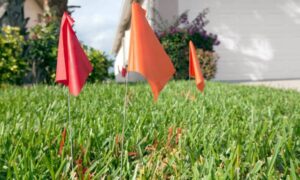
One of the hardest parts of coastal preservation is figuring out where new boundaries really are. A protected zone might shift as plants grow. Marshland may spread into higher areas. Water can change the shape of the shore.
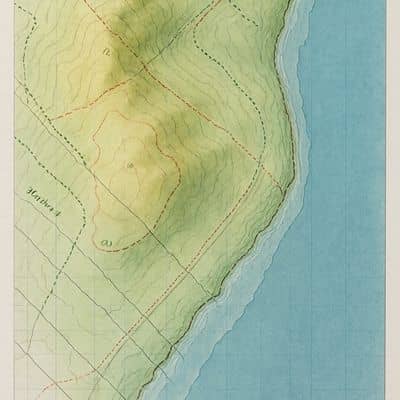
Drone surveying shows clear and updated images of these changes. From the aerial view, developers can see:
- Where marshland begins
- How far a buffer zone spreads
- Whether a fence or structure crosses a restricted line
- How the current land shape compares to older maps
This matters because even small mistakes with boundaries can lead to delays or fines. Agencies take conservation rules seriously, and developers need solid data to show that their plans follow the law.
Meeting New Environmental Requirements
Coastal preservation often brings new expectations for environmental reports. Many offices want fresh aerial images, updated surface models, or current elevation data before they review a design. Old ground surveys may not show the full picture anymore because the coast shifts so often.
Drone surveying supports these requirements by giving clean visual proof. A single drone flight can produce topography, 3D models, and detailed maps. Engineers use these tools to design drainage, stormwater systems, and safe building layouts. They can also avoid sensitive habitats or adjust plans early to follow the rules.
Understanding Floodplain and Shoreline Behavior
Flooding has always been a challenge in Houston, but the coastline adds even more risk. Tide changes, storm surges, and simple weather patterns can reshape the land. When areas become preserved, water movement often changes too.
Drone surveying helps developers see these patterns. Aerial data shows:
- How water flows
- Where erosion is starting
- Which spots stay wet for long periods
- How shoreline changes over time
These insights help engineers create stronger designs and safer plans. As storms become more unpredictable, this kind of information is essential.
Avoiding Problems Before They Grow
No developer wants to find out at the last minute that a project cannot move forward. A small misunderstanding about a protected area can cause a full redesign or a denied permit. Drone surveying helps prevent this.
A drone flight uncovers details that ground crews may miss. It shows natural edges of wetlands, the spread of habitats, and areas where building might cause damage. With this clear view, builders can make better choices before they apply for permits.
Developers also gain a better picture of the land they can actually use. Drone data often helps teams adjust the project to stay compliant rather than restarting from scratch.
Looking Ahead: More Preservation Means More Drone Data
Houston’s coastline will likely see more preservation work in the coming years. As storms grow stronger and sea levels rise, protecting wetlands and habitats becomes even more important. Each new protected area brings new responsibilities for developers.
Drone surveying will be a key tool in this process. It offers a safe and accurate way to understand land near protected areas. It also supports two important goals—good environmental care and smart urban growth.
Final Thoughts
Houston’s latest coastal preservation efforts show a strong commitment to protecting natural spaces. At the same time, development continues across the region. Drone surveying helps connect these two needs. It gives developers clear, current data while respecting the land that must be protected.
With stronger environmental rules and fast changes along the coast, drone surveying is now an essential part of building smart and building responsibly in Houston.