If you have a project scheduled in Houston this week, you need to pay attention. Recent GPS interference testing across parts of Texas has raised concerns for industries that rely on satellite positioning. While most people think this only affects airplanes or navigation apps, it can also impact survey mapping on the ground.
Now, that does not mean your project will fail. However, it does mean accuracy needs extra attention. And in Houston, even small coordinate shifts can turn into real problems.
What Is GPS Interference — And Why Should You Care?
GPS works by receiving signals from satellites in space. Survey equipment uses those signals to calculate precise positions on the ground. However, when interference happens, those signals can weaken or shift.
As a result, survey equipment may show slightly different coordinates than expected. Sometimes the shift looks small. Other times, it becomes noticeable.
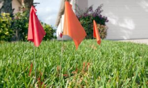
For example, a point that should sit at one location might move a few tenths of a foot. That may not sound like much. Still, on a construction site, even 0.10 to 0.20 feet can create costly issues.
In other words, this is not just a technical problem. It can become a financial one.
How GPS Instability Can Affect Survey Mapping
Survey mapping depends on precision. Contractors, engineers, and developers rely on those coordinates to build correctly. Therefore, when GPS behaves unpredictably, risk increases.
Here is how that risk shows up in real projects.
First, consider the foundation layout. If control points shift, building corners can land in the wrong spot. Crews might not notice immediately. However, inspectors will. Consequently, the project may face delays or expensive corrections.
Next, think about grading and drainage. Houston’s flat terrain demands tight elevation control. Small changes in slope can affect how water flows. Therefore, if survey mapping data shifts, grading crews might cut too much or too little. Later, drainage problems appear. Then the repair costs grow.
Many job sites also use GPS-guided equipment. While that improves speed, it increases reliance on satellite signals. If those signals drift, machines follow incorrect coordinates. As a result, operators may unknowingly grade the site wrong. That creates rework. And rework kills profit.
Why This Matters More in Houston
Houston brings unique challenges.
First, the city sits in a low-lying coastal area. Flood risk remains a constant concern. Therefore, accurate elevation data matters more here than in many other regions.
Second, many projects require strict compliance with floodplain regulations. If survey mapping data shifts even slightly, elevation certificates or drainage calculations may fail review.
Finally, Houston’s rapid growth means tight project schedules. Delays hurt more when crews, equipment, and inspectors already wait on site.
In short, inches matter here.
What Professional Survey Mapping Firms Do During GPS Disruptions

Now here is the good news.
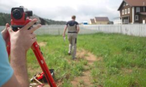
Experienced surveyors do not rely on GPS blindly. Instead, they build layers of protection into their workflow.
For example, they verify control points at the start of each day. If coordinates do not match known values, they investigate immediately.
Additionally, they take repeated observations. When numbers vary, they look for patterns before accepting data.
Many teams also use total stations and digital levels as cross-check tools. While GPS offers speed, traditional instruments provide strong verification.
Furthermore, professional surveyors monitor satellite health and signal quality in real time. If interference increases, they adjust methods.
Most importantly, they never assume the data is correct just because a screen says so.
That mindset protects clients.
Should You Delay Your Project?
Not necessarily.
If your project involves basic measurements or interior work, interference may not create noticeable problems. However, if your job includes foundation layout, grading, or flood-sensitive elevations, you should ask questions.
Before work begins, speak with your surveyor and ask how they verify control during GPS disruptions. Ask whether they check known benchmarks daily. Ask if they use backup instruments when signals shift.
A confident professional will answer clearly.
If the answers feel vague, you may want to reconsider.
Survey Mapping Is More Than Collecting Points
Some people think survey mapping simply means placing a rover on the ground and recording coordinates. In reality, it requires judgment and verification.
Technology helps. However, procedure matters more.
During weeks with GPS interference testing, that difference becomes clear. Crews that follow strict validation steps protect their clients. Crews that chase speed invite risk.
Therefore, the real question is not whether interference exists. The real question is whether your survey team knows how to handle it.
How Coordinate Shifts Turn Into Real Costs
Let’s connect this directly to your bottom line.
If layout shifts, you may pour concrete in the wrong place. If elevations drift, drainage fails inspection. If grading moves off design, engineers must revise plans.
Each correction adds labor, material, and time.
Moreover, change orders strain relationships between owners and contractors. That stress spreads across the entire project.
All of this can start from a small coordinate shift.
Stay Calm — But Stay Informed
GPS interference testing happens from time to time. It does not mean chaos. However, it does mean awareness.
Smart project managers treat this week as a reminder. They confirm procedures. They ask questions. They ensure their survey mapping provider verifies data carefully.
In Houston, where growth moves fast and flood control remains critical, precision protects investments.
If you have a project scheduled this week, reach out to your survey team. Confirm their verification process. Make sure they understand local conditions and current signal risks.
Because in the end, survey mapping does not just create lines on paper. It builds the foundation of your entire project.
And that foundation must sit exactly where it belongs.