A few days ago, a viral TreeLaw story exploded online. A homeowner came back from a short trip only to find an entire strip of trees missing along what they believed was their boundary. Their neighbor had taken a chainsaw to the whole row, leaving the yard bare and the homeowner furious. Thousands of people jumped into the comments to argue, give advice, or ask questions. Almost every reply said the same thing: “You need a lawyer and a property survey.”
This story spread fast because it hit a nerve. Many people assume they know where their boundary sits, yet they rarely have proof. And in a growing city like Houston—where trees, fences, and greenbelts run close together—assumptions can turn into expensive fights.
This article breaks down what happened in the viral story and explains why a property survey is one of the simplest ways to avoid the same mess. It’s written for everyday homeowners, not experts, and it focuses on what makes Houston properties especially tricky.
The Viral Story: A Costly Mistake That Could Have Been Avoided
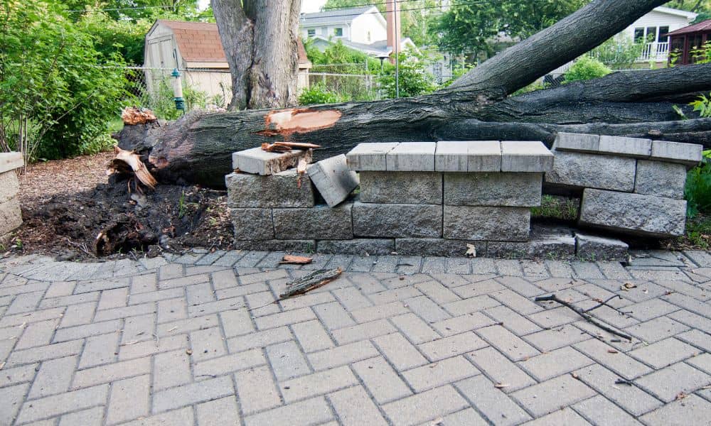
The whole thing started when a homeowner posted online about their missing trees. They had planted a line of them years ago for privacy and shade. While they were away, the neighbor decided those trees were on “their side” and cut them down. When the homeowner returned, they saw a long, raw strip of soil where their beautiful trees used to stand.
People reacted fast. Some shared their own nightmare stories. Others warned about the cost of damages. In many states, including Texas, cutting down a neighbor’s trees—even by accident—can lead to serious penalties.
But the root of the problem wasn’t anger or petty neighbor drama. It was simple: no one knew the real boundary. Both neighbors guessed. Both were wrong. And one decision with a chainsaw turned into a legal and financial disaster.
Why This Could Easily Happen
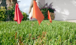
Houston has friendly neighborhoods, tall shade trees, and backyards full of character. However, it also has confusing boundaries. Fences often sit inside or outside the actual line. Trees grow right along the edge of a lot. Many homes back onto greenbelts, bayous, drainage paths, wooded buffers, or HOA strips. All these things make it hard to know where “your land” ends and “their land” begins.
Sometimes a previous owner built a fence slightly inward to avoid a tree root. Other times, builders installed fences before a property survey was done, so the fence never matched the legal line. Even natural features shift the picture. A tree leans, a hedge spreads, a ditch widens, or a cluster of bushes grows in a curve.
To the eye, it might look clear. On paper? It’s a different story.
Because of these small, ordinary changes, many homeowners trust visual boundaries that are not accurate. This is exactly how small misunderstandings grow into big conflicts.
The Real Issue: Boundaries People “Think” They Know
Most people don’t go outside and say, “I bet this fence is 18 inches off.” We assume the visual line is correct. We believe what the last owner told us. Or we trust the path the lawnmower always follows.
But none of those things are legal evidence.
In the viral TreeLaw story, the neighbor thought the trees were too close to their yard. The homeowner thought the trees were safely inside their boundary. Neither had a survey to back it up. One acted, and the damage was permanent.
This is why emotions run high in boundary problems. Both sides always think they’re right. Unlike loud cars or barking dogs, boundary disputes hit pride, money, and privacy all at once.
How a Property Survey Solves the Problem Before It Starts

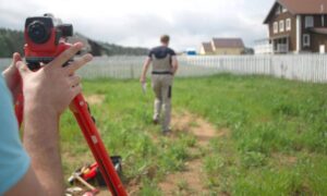
A property survey gives you the truth on paper. It shows where your land starts and ends, even when fences or trees make it look different. And because a survey is done by a licensed professional, it becomes the document everyone trusts in a disagreement.
A surveyor doesn’t guess. They measure the land using recorded plats, deed descriptions, markers, and precise tools. They look at old documents, match them with what exists today, and mark the legal line. And honestly, once people realize how much clarity it brings, they usually say, “I should’ve called a land surveyor near me a long time ago,” because the stress of not knowing goes away almost instantly.
With this information, you can answer simple but important questions:
- Are those trees actually on your lot?
- Is your fence on the true boundary?
- Has your neighbor’s garden crept over the line?
- Are you safe to remove a tree without starting a fight?
A property survey removes the “I think” from the conversation. Once you know the exact line, arguments usually disappear because everyone is working from the same facts.
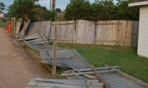
Real-Life Situations Where a Survey Saves You
Tree conflicts aren’t rare. In Houston, they happen more often than you might expect. Maybe you’ve seen signs something is off:
- A big oak tree sits right between two yards.
- Your neighbor trimmed branches that hang over their fence but went too far.
- Someone installed a new fence, and it looks farther into your yard than the old one.
- A yard crew cleared brush near a bayou, and now the natural boundary looks different.
- A row of shrubs has always acted like a divider, but no one knows who planted them.
Any of these moments could lead to tension. A property survey gives both sides a clear picture so no one has to guess—or worse—act based on a wrong assumption.
What Homeowners Should Do Before Touching Trees Near a Boundary
If you’re thinking about cutting, trimming, removing, or planting trees near a shared line, pause for a moment. One quick check today can save months of arguments later.
Start with the basics. Look at the area and see if anything feels “too close to call.” Walk the boundary and imagine how a mistake could affect your relationship with your neighbor. Then, order a property survey if you don’t already have one. It’s a small investment compared to the cost of replacing mature trees or dealing with legal claims.
After you get the survey, talk to your neighbor openly. Share what you found. Most people feel relieved when they see a clear map because it takes the pressure off both sides.
If your neighbor plans to clear or trim trees, showing them an accurate survey could prevent the same nightmare the viral homeowner faced.
What to Do If Your Neighbor Already Cut Your Trees
If you come home to missing trees, stay calm. This happens more than you think, and the first step is not yelling—it’s gathering facts.
Take photos. Pull out your most recent survey. If you don’t have one, get a new survey right away. With a survey in hand, you can talk to your neighbor clearly. You’ll both know where the line really sits.
If the survey proves they crossed onto your land, you have solid evidence for repairs, replacement, or legal action if needed. But in many cases, a survey helps both sides settle things without conflict.
Final Thoughts:
The viral TreeLaw story was dramatic, but the lesson is simple. You can avoid almost all boundary disputes with one document: a property survey. It protects your yard, your trees, your wallet, and your peace of mind.
Houston is full of beautiful trees and strong communities. Because of that, it’s better to know your true boundary before you cut, plant, or clear anything near a shared line. A small step today keeps you out of a big problem tomorrow.