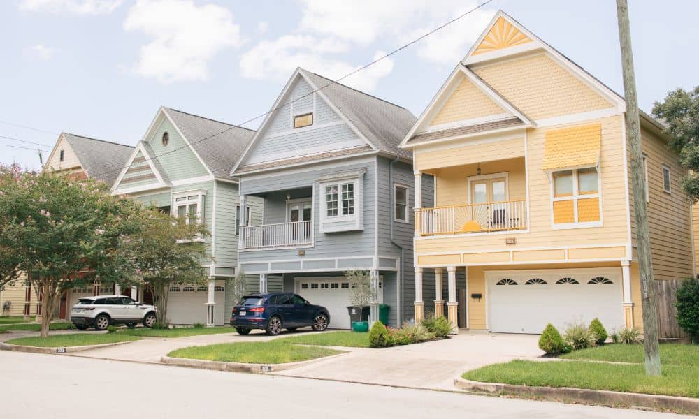
A boundary survey is an essential process for property owners, developers, and anyone involved in buying land in Houston, Texas. It defines the exact legal boundaries of your property—so you know precisely where your land ends and your neighbor’s begins.
In a growing and regulated city like Houston, getting a boundary survey done correctly can prevent costly disputes, help you stay compliant with local rules, and protect your investment. This article covers everything you need to know about boundary surveys in Houston—from how they work to why they matter.
What is a Boundary Survey?
A boundary survey is conducted by a licensed professional surveyor to determine the exact legal boundaries of a property. It involves physically measuring the land, reviewing historical records, and marking the corners of the lot.
For those wondering what is the purpose of a boundary line, it’s to clearly define where your property ends and your neighbor’s begins. This clarity prevents disputes, supports legal compliance, and ensures that all improvements or structures remain within your own land.
By making property lines official and visible, a boundary survey provides legal assurance for homeowners, buyers, and developers alike.
How it Differs from Other Types of Surveys
A boundary survey is different from other types of surveys like topographic or ALTA surveys. A topographic survey shows the land’s natural features, and an ALTA survey is more detailed for real estate deals. A boundary survey focuses only on the land’s boundaries and property lines.
Key Components of a Boundary Survey
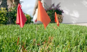
A boundary survey includes finding the corners of the property, looking at land records, measuring distances, and creating a map that shows the property’s lines. It may also include any physical markers like fences or walls.
Why Boundary Surveys Are Essential in Houston
Legal Protection of Property Boundaries
Boundary surveys protect your legal rights by confirming that your structures (fences, buildings, etc.) are within your property lines. In Houston, where dense development can lead to overlapping interests, this clarity is essential.
Preventing Property Disputes
With Houston’s rapid urban growth, disputes between neighbors over fences, driveways, or trees are common. A boundary survey provides legal clarity to resolve or even prevent such conflicts.
Ensuring Accurate Property Descriptions in Transactions
Real estate deals depend on legal accuracy. A boundary survey ensures that what’s on the ground matches the property’s legal description, helping you avoid errors in deeds and paperwork.
Common Uses of Boundary Surveys in Houston
1. Property Purchases and Sales
Before buying or selling property, boundary surveys confirm the size and layout of the land. This avoids last-minute surprises at closing.
2. Fence Installations and Neighbor Disputes
Boundary surveys are often used when:
- Building a new fence or wall
- Confirming ownership in disputed areas
- Avoiding encroachment lawsuits
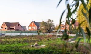
3. Land Development and Construction
Developers and builders need clear boundary data to:
- Design building placements
- Comply with Houston’s zoning codes
- Avoid construction over setbacks or easements
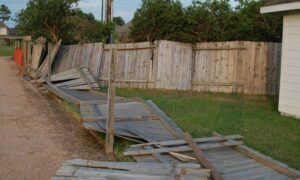
4. Resolving Encroachments
If a neighbor’s structure crosses onto your land (or vice versa), a boundary survey provides legal evidence for resolution—whether that’s through negotiation or court.
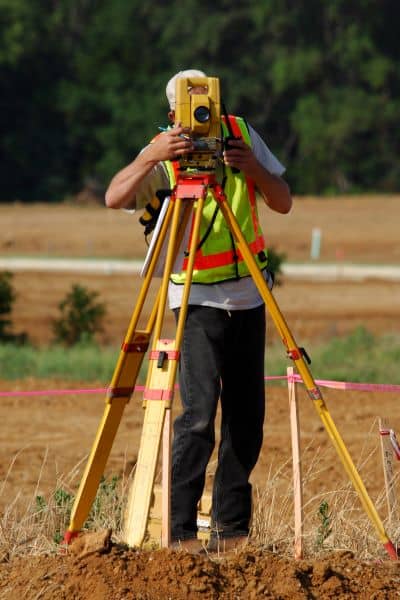
How Boundary Surveys Are Conducted in Houston
Steps Involved
- Research – The surveyor reviews deeds, plats, and past surveys.
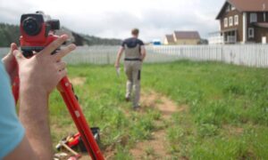
- Fieldwork – Site visits involve measuring land using GPS and total stations.
- Analysis – Data is compared with legal documents to detect discrepancies.
- Documentation – A certified boundary map is prepared showing all corners, lines, and encroachments.
Equipment and Technology
Houston surveyors often use:
- GPS (Global Positioning Systems)
- Total stations and lasers
- CAD software for mapping
Role of a Licensed Surveyor
Only licensed surveyors in Texas can conduct legal boundary surveys. They ensure compliance with state law and produce documents that hold up in court if necessary.
Typical Duration
- Small residential lots: 1–2 business days
- Larger or irregular parcels: Up to a week
Your surveyor should provide an estimated timeline based on property complexity.
Legal and Regulatory Aspects in Houston
Texas State Laws and Local Rules
Surveys must follow the Texas Board of Professional Land Surveying guidelines and local Houston ordinances related to land use, access, and zoning.
Why Licensing Matters
Hiring a licensed professional ensures that your survey is:
- Legally recognized
- Compliant with state and local laws
- Accepted by title companies, attorneys, and courts
Recording Survey Results
While not all boundary surveys are automatically recorded, they’re often attached to property records or used in title updates, disputes, and permits.
Choosing the Right Surveyor in Houston
What to Look For
- Texas licensure
- Local Houston experience
- Transparent pricing and timelines
- Clear communication
Credentials and Reviews
Ask about:
- Years in business
- Sample reports
- Client testimonials or Google reviews
Smart Questions to Ask Before Hiring
- Can I use this survey in legal matters or real estate transactions?
- How many boundary surveys have you done in Houston?
- What equipment do you use?
- Will you mark the corners on-site?
Final Thoughts
A boundary survey is more than just measuring land—it’s a critical legal safeguard for property owners in Houston. Whether you’re buying a home, building a fence, resolving a neighbor dispute, or starting a construction project, a professionally done survey ensures you’re working with accurate, legally sound property lines.
By hiring a licensed and experienced Houston surveyor, you can protect your land, avoid legal issues, and move forward with confidence.