Buying or developing property comes with a lot of moving parts. If a bank or title company is involved, one requirement almost always pops up: the ALTA Land Title Survey. This detailed survey is the gold standard for showing boundaries, easements, and improvements. But in Houston, with its floodplains, complex easements, and strict lender rules, getting an ALTA survey right the first time saves both time and stress. The good news? With the right steps, you can avoid delays and sail through closing.
Why the ALTA Land Title Survey Matters in Houston
Across the U.S., an ALTA survey makes sure a property’s boundaries and legal details are crystal clear. In Houston, it does even more. The city’s flood zones, drainage rules, and patchwork of old plats mean lenders and title companies won’t release funds without a survey that hits every mark. If your survey is missing a flood note, shows the wrong datum, or leaves out a benchmark, your closing could grind to a halt. That’s why ordering it correctly from the start is so important.
Start With the Right Benchmark
The first step to avoid trouble is choosing the right benchmark. In Houston, surveyors often use Harris County Floodplain Reference Marks. These marks include a photo, sketch, and permanent ID number, which proves the elevation data is tied to a reliable source. A solid benchmark keeps everyone—engineers, lenders, and title officers—on the same page.
Skipping this step or picking a weak benchmark can throw off all elevation measurements. If the numbers don’t match what the title company expects, you risk weeks of back-and-forth corrections. Starting with the correct benchmark means your ALTA survey holds up under review.
Check Your Datum (and Don’t Mix Them Up)
Once you have a benchmark, you need to confirm the vertical datum. In simple terms, a datum is the “zero point” that surveyors use to measure elevation. Houston uses the NAVD88 datum, but older surveys may still show NGVD29. Mixing these up can cause a mismatch of several feet. That’s enough to flag your survey as unreliable.
Surveyors prevent this by checking official NGS datasheets. They note the correct datum and include a statement right on the face of the survey. This way, lenders and insurers know exactly which standard was used. When the datum is clear and correct, you avoid one of the most common causes of closing delays.
Understand MAAPnext vs. FEMA Flood Maps

Flood risk is a major concern. Two main map sets come into play: FEMA’s effective Flood Insurance Rate Maps (FIRMs) and MAAPnext, the county’s advanced flood modeling system. Here’s the tricky part: FEMA maps are still the legal standard for insurance, but local reviewers often look at MAAPnext for planning and permitting. If your survey only shows one without context, questions pile up.
A smart ALTA survey in Houston mentions both. It explains which governs insurance (FEMA) and which informs local development rules (MAAPnext). That single note can stop weeks of lender or reviewer confusion.
Know Where to File and Who Reviews It
Houston properties don’t all go through the same review process. Inside city limits, the Houston Permitting Center Floodplain Office handles survey and elevation certificate reviews. In unincorporated areas, the Harris County Office of the County Engineer takes over. If your property sits in enclaves like West University or Bellaire, those cities have their own requirements.
Why does this matter? If your survey package goes to the wrong office, you lose valuable time. A good surveyor knows where to file and what forms—like fill affidavits or driveway permits—need to be included.
Order the Right Table A Items
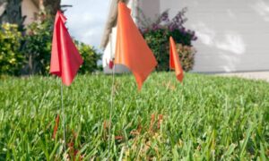
ALTA surveys allow for optional “Table A” items, which add more detail when lenders or buyers want it. In Houston, it’s smart to include items like easement locations, building setbacks, and utility evidence. These help title companies confirm that nothing important was missed.
Adding too many extras, though, can slow things down. The key is balance: request the Table A items that protect you without overloading the surveyor. Local surveyors who know Houston’s quirks will guide you on which items matter most for your property type.
Common Pitfalls That Delay Surveys
Even a strong survey can get hung up if details are overlooked. Some of the biggest delay triggers include:
- Using an outdated benchmark that no longer checks out
- Forgetting to note the vertical datum clearly
- Leaving out a flood note or referencing only one set of maps
- Missing easements that appear in the title commitment
Each of these issues can cause a lender or title officer to send your survey back for revisions. That means more time and sometimes more money. Catching them early keeps your project on track.
Speed Up the Timeline
Ordering an ALTA Land Title Survey doesn’t have to drag out for weeks. You can save time by:
- Sharing documents early: Give your surveyor the deed, prior plats, and title commitment on day one.
- Requesting utility locates up front: Some Table A items require utility confirmation, which can take time.
- Clarifying contacts: Make sure your surveyor has direct lines to your lender and title company to clear questions fast.
These small steps can shave days off the process and reduce stress for everyone involved.
Final Thoughts:
Ordering an ALTA Land Title Survey is more than a checkbox. It’s about aligning benchmarks, datums, and flood data so lenders, title companies, and insurers can all agree. By choosing the right surveyor, confirming the control points, and filing with the right office, you can turn a potential headache into a smooth, on-time closing.
If you’re about to buy, sell, or develop property, don’t leave this step to chance. Work with a licensed land surveyor who understands unique conditions and knows how to deliver a survey that passes the first review. The result? No delays, no costly surprises, and a clear path to closing.