If you work with property, construction, or land in Houston, you’ve likely heard of an ALTA Land Title Survey. It’s showing up in more projects than ever — and this week, it matters most. Texans are voting on new plans to fund water, drainage, and flood-control improvements. These decisions will shape where new projects rise, which neighborhoods change, and how land ownership shifts across Harris County. When that much money moves into public works, the need for surveys and title checks always follows.
Houston’s Flood Problem Meets Election Week
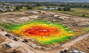
The timing feels familiar. Early November brought heavy rain and more talk about Houston’s flooding problems. Each storm reminds us that drainage isn’t only about comfort — it protects homes, roads, and property values.
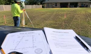
If voters approve more funding, the city and county will start work on new drainage channels, detention basins, and levee upgrades. But before any crew breaks ground, someone must confirm who owns each piece of land, what easements exist, and where those lines are. That’s where an ALTA Land Title Survey becomes essential.
From Ballots to Building Sites
When the state releases new funding, local teams move fast to plan projects. They look for land to buy, adjust easements, and check property lines. None of that happens without an accurate, current ALTA survey.
Here’s how it plays out:
- The state approves funding.
- Local governments plan flood-control projects.
- Engineers design routes and expansion areas.
- Title companies and lenders ask for updated surveys before closing.
Each step depends on good survey data. If boundaries or ownership details are unclear, projects slow down and costs rise.
Where Houston Could See Change First
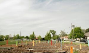
Flood-control work usually starts in the areas hit hardest by past storms — near bayous, older subdivisions, and low-lying industrial zones. If your property sits near one, these new funds could bring changes soon.
- Drainage expansion areas: Homes and businesses near Brays, White Oak, or Greens Bayou may need updated surveys as new right-of-way plans take shape.
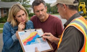
- Buyout programs: Owners in flood-risk neighborhoods might receive acquisition offers; a current ALTA survey makes that process faster.
- Public-private projects: Developers working beside future detention sites or levees will need clear title records before lenders release funds.
Even if your property isn’t in these zones, nearby projects can shift boundaries, easements, and access routes. Old surveys may no longer match reality.
Why Ordering Early Pays Off

Many property owners wait until a sale or loan closing to order a survey. By then, surveyors are already booked. Once new flood-control projects begin, crews get busy, and timelines stretch from weeks to months.
Ordering an ALTA Land Title Survey early helps you:
- Spot easement or title issues before they delay your deal.
- Negotiate with clear facts during a buyout or property sale.
- Avoid rush fees when survey demand peaks across Houston.
Think of it as insurance for your paperwork — it saves stress and protects your timeline.
Why Everyone Benefits
Developers use ALTA surveys to confirm that the land they buy is free of boundary or drainage-access problems.
Lenders depend on them to verify that the property matches what’s listed in the loan documents.
Homeowners gain peace of mind, knowing their property lines are correct before any government or nearby construction affects them.
No matter your role, solid survey data keeps every transaction fair and simple.
Looking Ahead to 2026
The election results this week will shape Houston’s next round of projects. Once funds are approved, cities and counties will start building their 2026 work lists. That means hiring engineers, securing parcels, and scheduling survey crews.
Anyone who acts now — property owners, developers, and lenders — will stay ahead. Having your survey ready means you can respond quickly when new drainage plans or acquisition notices arrive early next year.
Final Thoughts
Houston’s future depends on how it manages water — not just in pipes, but in planning. As voters decide on new funding, property owners and developers should get ready for what comes next.
An ALTA Land Title Survey isn’t just a closing document; it’s a tool for protection and planning. Order it early, know your boundaries, and stay prepared for the growth and flood-control projects this election could set in motion.