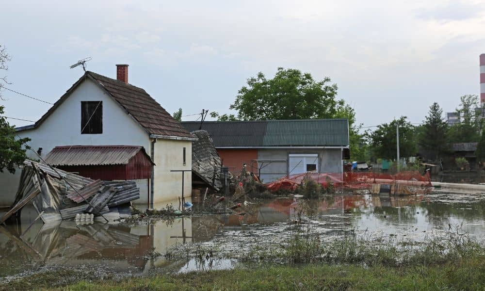
Houston is preparing for another round of heavy rain. City officials have started lowering Lake Houston by about a foot to prevent flooding, and storm alerts are already in effect. For most homeowners, this just means getting ready for wet weather. But for anyone with property near a bayou, drainage ditch, or low-lying area, it could mean something more serious — shifting soil, hidden erosion, and blurred property lines. That’s where a boundary survey becomes more important than people realize. When the ground moves, even slightly, the physical signs that mark your property can move too. And when those markers shift, it can lead to costly mistakes later — especially if you’re planning repairs, building a fence, or getting ready to sell your home.
Rain Doesn’t Just Flood Streets — It Moves the Ground Beneath Them
When a week of storms passes through Houston, water doesn’t simply soak in and disappear. It saturates the soil, softens embankments, and slowly reshapes how land sits. In neighborhoods near Lake Houston or along the bayous, this process happens almost every season.
After a few days of downpours, the soil around fence posts, retaining walls, or boundary markers can loosen. Sometimes, stakes get buried deeper or shift slightly out of position. It might not look like much — maybe just an inch or two — but that tiny change can throw off property lines. For a homeowner who builds or repairs something based on those misplaced markers, that’s enough to cause an encroachment problem later.
The Hidden Risk: Boundary Markers Don’t Always Stay Put
Most property owners never see their survey markers again after they buy their house. They’re usually small iron pins or capped rods placed at the corners of the lot. Over time, landscaping, flooding, or construction can hide or disturb them.
When a storm like the one forecast this weekend hits, heavy runoff can wash away topsoil, push stakes out of alignment, or bury markers completely. And once those physical references are gone, your fence line or garden bed might end up sitting outside your true property boundary.
That’s why surveyors recommend checking your property after major weather events. You don’t have to dig up the yard, but walk around and look for signs of change: shifted soil near corners, fence lean, or areas where water pooled heavily. Those are clues your ground may have moved.
Houston’s Lake-Lowering Effort and What It Means for You
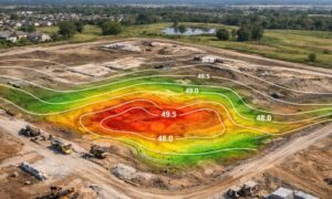
Lowering Lake Houston by 12 inches may not sound like a big deal, but it changes how stormwater moves across nearby land. The city does this to create room for runoff from incoming rainfall — a smart move to reduce flooding. Still, these adjustments can influence nearby properties.
As water levels drop and rise again, the soil expands and contracts. Over time, that can slightly change the ground elevation or slope, especially near the edges of properties close to drainage channels. For residents in northeast Houston and Kingwood, this weekend’s cycle of lowering and refilling can leave a noticeable mark on the terrain.
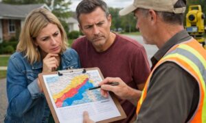
If you live in those areas, it’s worth confirming that your property markers are still where they should be. It’s not about panic — it’s about being proactive. A quick call to a local surveyor can confirm everything is still accurate.
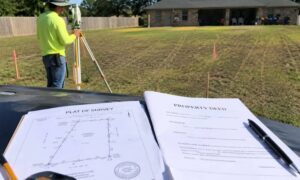
How a Boundary Survey Helps After Major Rain
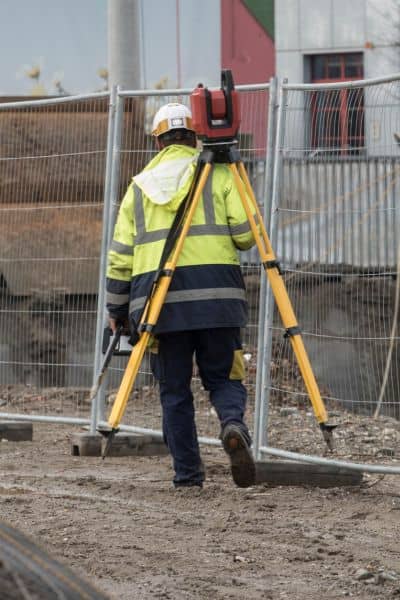
A boundary survey re-establishes the exact legal edges of your property. The surveyor reviews your deed and plats, then uses precise equipment to locate or replace missing markers. This process ensures that what’s recorded in legal documents still matches what’s on the ground.
After heavy storms, that confirmation matters. It prevents you from making repairs, landscaping changes, or construction decisions based on inaccurate visual cues. It also helps when dealing with neighbors — no one enjoys arguing about who owns which side of a fence or retaining wall.
In many cases, surveyors also note erosion zones and potential encroachments caused by storm movement. That means you’ll know early if you need to take action before the problem grows.
New Stormwater Projects May Shift the Lines Too
Just this week, Houston’s City Council approved a new stormwater detention basin project to improve flood control in the southwest part of the city. These public drainage improvements are great news for flood prevention, but they sometimes alter easements or access routes around residential lots.
When the city updates drainage infrastructure, it can lead to new right-of-way boundaries or maintenance easements. Property owners who live near those zones might see small but meaningful adjustments to how their land connects to public systems. A current boundary survey ensures that you have a clear, legal record of your property’s true limits if those changes happen nearby.
Real Problems Start Small
Imagine fixing a fence after this weekend’s storms. You replace a few posts and shift the line slightly uphill where the soil looks more stable. Months later, your neighbor hires a surveyor for a renovation — and it turns out part of your new fence crosses their property.
That simple storm repair could turn into a legal dispute or force you to tear down your work. It’s a headache no homeowner wants. In another case, a retaining wall might slump after prolonged rain, leading to drainage conflicts or property damage claims. A boundary survey done before rebuilding helps you avoid those surprises.
When It’s Time to Re-Survey
You don’t need to schedule a boundary survey after every rainfall. But it’s smart to get one if:
- You notice visible erosion, washouts, or fence movement.
- You plan to rebuild or add structures near your lot edges.
- Your property sits next to a ditch, bayou, or drainage channel.
- You’re preparing to sell or refinance, and your last survey is several years old.
In those situations, a boundary survey acts like an insurance policy — proof that your land boundaries remain correct despite natural changes around you.
Houston’s Changing Landscape Calls for Vigilance
Houston is a city built on soft, shifting ground. Between stormwater management projects, rapid development, and recurring floods, the land itself is in constant motion. Homeowners can’t stop that, but they can stay ahead of it.
Understanding where your boundaries are — and confirming that they haven’t changed — keeps you legally protected and financially safe. The cost of a survey is small compared to the expense of rebuilding a fence, correcting drainage, or settling a dispute.
Final Thoughts
As the city prepares for another round of storms, take a moment to think beyond sandbags and rain gutters. The ground beneath your home is part of a bigger system — one that reacts to every inch of water Houston receives.
A boundary survey may not stop the rain, but it will protect your most important investment: your property. Whether you live near Lake Houston, along Buffalo Bayou, or anywhere water tends to linger, checking your boundaries after a major weather shift is a simple way to prevent bigger problems later.
If this weekend’s storm brings more than puddles, it might be time to call a local surveyor and make sure your boundaries haven’t moved.