Houston is slowly sinking. And no, that’s not just a dramatic headline. Scientists recently discovered that parts of the city are dropping by as much as an inch every year. This quiet shift in the ground may not seem like a big deal at first, but it can seriously affect your property—especially when it comes to flooding. That’s where an elevation certificate becomes important. If you live in Houston, you may already need one. If not now, possibly soon.
So what’s really going on beneath our feet? And why should homeowners, buyers, and builders care?
The Ground Beneath Houston Is Sinking — Here’s Why
Over the past few years, researchers have used satellites to measure land levels across major U.S. cities. What they found shocked many Houstonians: their city is among the fastest sinking in the country.
This sinking, called land subsidence, happens when the ground gets compressed and starts to sink. In Houston, that’s mainly caused by two things:
- Pumping too much groundwater and oil.
- Clay-rich soil that collapses easily when dry.
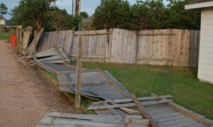
As companies pull water and oil from underground, the layers of soil lose support. The land above slowly drops, causing cracks, dips, and even uneven roads and foundations. But the biggest concern? Flooding.
Sinking Land = Rising Flood Risk
Houston is already known for major floods—just ask anyone who lived through Hurricane Harvey. But with the land sinking in many areas, water has fewer places to go. That makes some neighborhoods more likely to flood than they were even just a few years ago.
If your home was once outside a flood zone, you might now be inside one. FEMA (the Federal Emergency Management Agency) updates flood maps regularly based on new risks. And if your area gets re-zoned as high-risk, you’ll likely need flood insurance.
But before you can get flood insurance, especially through the National Flood Insurance Program (NFIP), there’s one document most people will need: the elevation certificate.
What Is an Elevation Certificate?
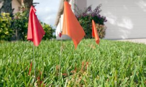
An elevation certificate is an official document that shows the height of your property compared to the base flood level in your area. It tells FEMA and insurance companies how likely it is that your home will flood.
Here’s what it includes:
- Your home’s elevation (height above sea level)
- The flood zone your home is in
- The base flood elevation (the height where flooding is likely to happen)
- Structural details like the lowest floor, vents, and more
If your home sits above the base flood elevation, your insurance could be cheaper. If it’s below, your rates might be higher—or you may be required to take extra precautions.
Why Houston Homeowners Should Care
With so much of Houston sinking, many areas are getting closer to the flood level—even if they weren’t before. That’s bad news for homeowners who thought they were in the clear. If FEMA updates your flood zone, and you’re now in a high-risk area, your lender might require flood insurance.
No elevation certificate? You may not get coverage—or you may pay more than you need to.
Even worse: after a flood hits, it’s too late to fix things.
Do You Need a New Elevation Certificate?
Here are some signs that you may need a new or updated elevation certificate:
- Your property is in a known subsiding area (like parts of northwest or southeast Houston)
- You’re buying or refinancing a home near a floodplain
- You’ve made changes to your home (like adding a room or building up the ground)
- Your current elevation certificate is over 5 years old
- Your insurance company or lender asks for it
And even if no one’s asked yet, getting one now could save you money—or a major headache—later.
Who Can Provide It? (Hint: Not Just Anyone)
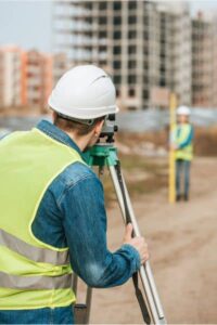
Only a licensed land surveyor, engineer, or architect can create an official elevation certificate. And in Houston, it’s smart to choose someone local. A Houston-based surveyor understands the city’s unique soil conditions, flood history, and the areas most affected by subsidence.
Getting an accurate elevation certificate starts with a detailed land survey. This survey measures your property’s precise boundaries and elevation, giving a clear picture of how your land is affected by sinking or flooding risks. Modern surveyors also use tools like drone surveying and GPS mapping to get the most accurate results. These technologies make surveys faster, safer, and often more affordable than you might think.
What Happens Without One?
Let’s say your home floods and you file an insurance claim. If your insurance provider doesn’t have clear data about your home’s elevation, you might:
- Get denied coverage
- Receive a lower payout
- Be required to pay more for future insurance
- Face delays in rebuilding or getting permits
Having an elevation certificate on file makes everything smoother—especially during an emergency.
Don’t Wait for the Water
Houston’s land isn’t going to stop sinking overnight. As the city continues to grow and shift, flood risks will only become more complex. And since flood maps often lag behind real-world conditions, it’s better to be proactive than reactive.
An elevation certificate isn’t just a piece of paper. It’s a powerful tool that helps protect your home, your investment, and your peace of mind.
Whether you’re buying a new home, updating your insurance, or just staying prepared—now’s the time to talk to a local, licensed land surveyor.
Final Thought
Flooding may be natural, but being unprepared doesn’t have to be. In a city where the ground itself is changing, your smartest move is to stay ahead of it.
Your property hasn’t moved—but the ground under it might have.
Get your elevation certificate before the next flood season hits.