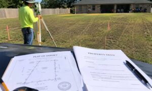
If you’ve ever needed to confirm your property lines—maybe before building a fence or settling a boundary issue—you’ve probably wondered, Where can I get a copy of the survey of my property in Texas? A property survey is an important document that outlines your land’s exact boundaries, structures, and easements. It’s useful for avoiding disputes, ensuring zoning compliance, and handling real estate transactions.
In this guide, we’ll go over the best places to find your property survey, why you might need one, and what to do if you can’t locate a copy.
What Is a Property Survey, and Why Do You Need One?
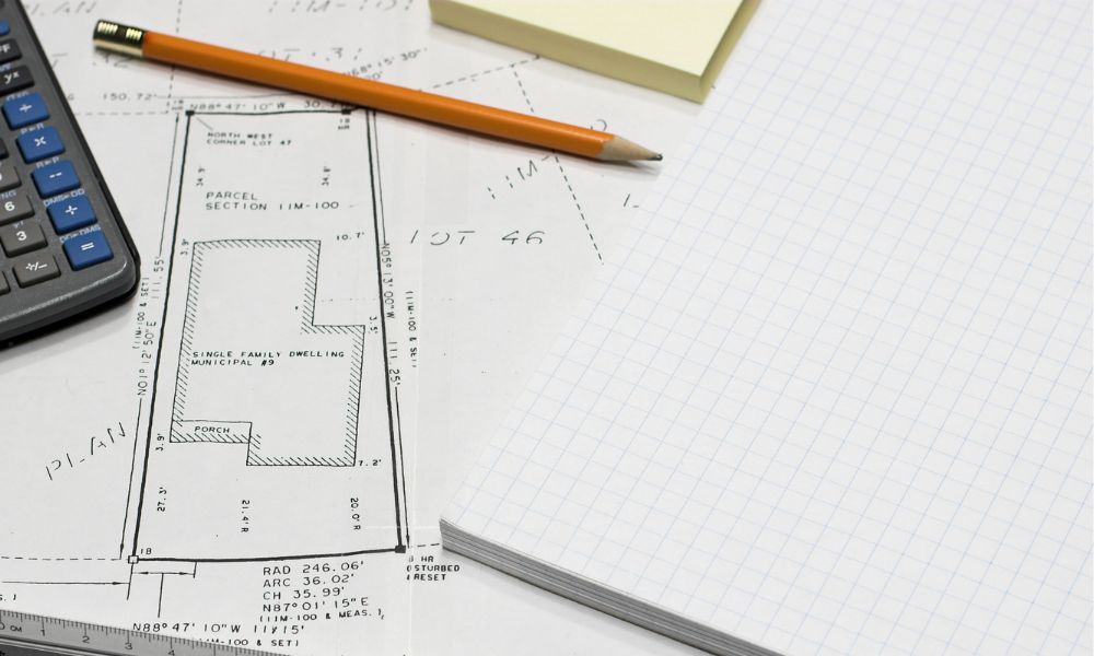
A property survey is a detailed map created by a licensed surveyor. It shows:
✔️ Your property’s boundary lines
✔️ Any buildings, fences, or driveways
✔️ Easements that allow utility companies or others access to parts of the land
You might need a survey if you’re:
- Buying or selling a home – Many buyers (and lenders) require a survey before closing a real estate deal.
- Building a fence or structure – Knowing where your property lines are can prevent encroachments.
- Handling a boundary dispute – A survey provides legal proof of property ownership.
- Applying for a mortgage or refinancing – Some lenders require a survey as part of the loan process.
Where to Get a Copy of Your Property Survey in Texas
If you don’t already have a copy, here are a few places to check:
1. County Clerk’s or Recorder’s Office
Many property surveys are filed with the county, though not all. To check:
- Visit the County Clerk’s Office in the county where your property is located.
- Provide details like your property’s address or parcel number.
- Some counties offer online records search tools, which can save you a trip.
2. Title Company or Mortgage Lender
If you bought your home recently, the title company that handled the closing may have a copy of the survey. Likewise, your mortgage lender may have kept a record of it during the loan approval process.
3. Local Surveying Companies
Surveyors often keep records of past work. If your property was surveyed recently, the company that did it might still have the file. Call a few local surveying firms and provide your property details. If they don’t have it, you may need to hire a surveyor to conduct a new one.
4. Online Public Records and Government Resources
Some property surveys are available through public records. You can check:
- The Texas General Land Office (GLO) for historical property maps.
- Your county’s GIS (Geographic Information System) database—some include survey details.
- The county tax assessor’s office (though they usually have boundary maps, not official surveys).
What If You Can’t Find Your Property Survey?

If you’ve checked all these sources and still can’t find your survey, your best option is to hire a licensed surveyor to create a new one. The cost typically ranges from $300 to $1,000, depending on your property’s size, location, and complexity. While it’s an expense, having an updated survey can save you from legal and financial headaches down the road.
How to Read and Understand Your Property Survey
Once you get your survey, here’s what to look for:
- Boundary lines – Marked to show exactly where your property begins and ends.
- Structures – Locations of buildings, fences, driveways, etc.
- Easements – Areas where utility companies or other parties have access rights.
- Encroachments – Any structures crossing into neighboring properties.
Frequently Asked Questions (FAQs)
1. How long is a property survey valid?
There’s no official expiration date, but lenders and local authorities may require a new one if major changes have been made to the property.
2. Can I use an old survey for new construction?
Sometimes, yes. But if the property has changed significantly, you may need an updated survey.
3. Who pays for a survey in a real estate transaction?
It depends on the contract. In Texas, buyers often pay, but it’s negotiable.
4. Are property surveys public records?
Not always. Some surveys are filed with the county, but others stay with private surveyors or title companies.
5. What if I think a property survey is incorrect?
If you believe there’s an error, hire another licensed surveyor for a second opinion. If necessary, legal action may be required to resolve disputes.